While in Florida
- Attraction Costs
- Beaches
- Currency
- Dinner Shows
- Disney World Orlando
- Driving
- Eating Out
- Florida Areas
- Florida Events
- Florida Hospitals
- Golfing
- Nightlife
- Other Attractions
- Other Theme Parks
- Severe Weather Advice
- Shopping
- Space
- Sport Watching
- Theme Park Tips
- Water Parks
- Where To Go
- WI-FI HotSpots Florida
Before Travelling
Accommodation
About Florida
Other

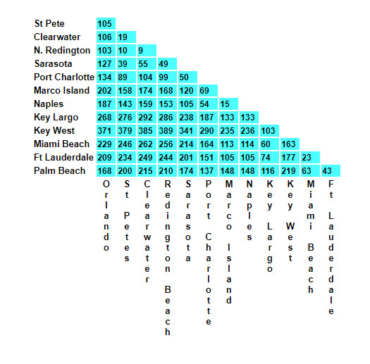
Florida is BIG but the highways are great.
Below is a simple chart showing approximate driving distances from the main cities.
Florida Driving Distances Chart:
I would always advise getting or using your own Sat-Nav and Dash-cam. I have used mine often and it is a great help.